
This past weekend I decided, a bit spontaneously, to take on the challenge of summiting a 14er, which is a mountain with a summit at 14,000+ feet in elevation. I’ve already completed three other Colorado 14ers (Mount Sherman, Mount Bierstadt, and Pikes Peak) and wanted to check off another: Mount Evans. While there’s actually a paved road leading all the way to the top of Mount Evans, there are also a variety of routes you can take to hike to the summit. I opted for the Summit Lake to Mount Evans route which is considered a moderate hike, but fairly easy compared to other Colorado 14ers. At around 5.5 miles roundtrip with 2,000′ of elevation gain, the hike is challenging but relatively beginner-friendly. This hike is also rated Class 2 out of 5, meaning it has minimal exposure/risk. Some hikers will argue that you only properly summit a 14er if the route has at least 3,000+ feet of elevation gain, but I say: hike your own hike and be proud of yourself regardless!
The trail begins at Summit Lake in Mount Evans Wilderness. You will need to purchase a $2 timed-entry reservation to park here, but if you arrive before 8am you can just display the printed reservation in your windshield, regardless of what time slot it’s for. There is also a $5/vehicle fee which you self-pay at the parking area, unless you are an interagency pass holder in which case you only have to worry about the reservation fee (display your pass in the windshield as well). More info can be found at Recreation.gov. I arrived around 6:15am and the main parking lot was already full, so I had to park in an overflow spot along the road. Mount Evans is an incredibly popular hike so if you visit on a weekend, plan to arrive as early as possible.
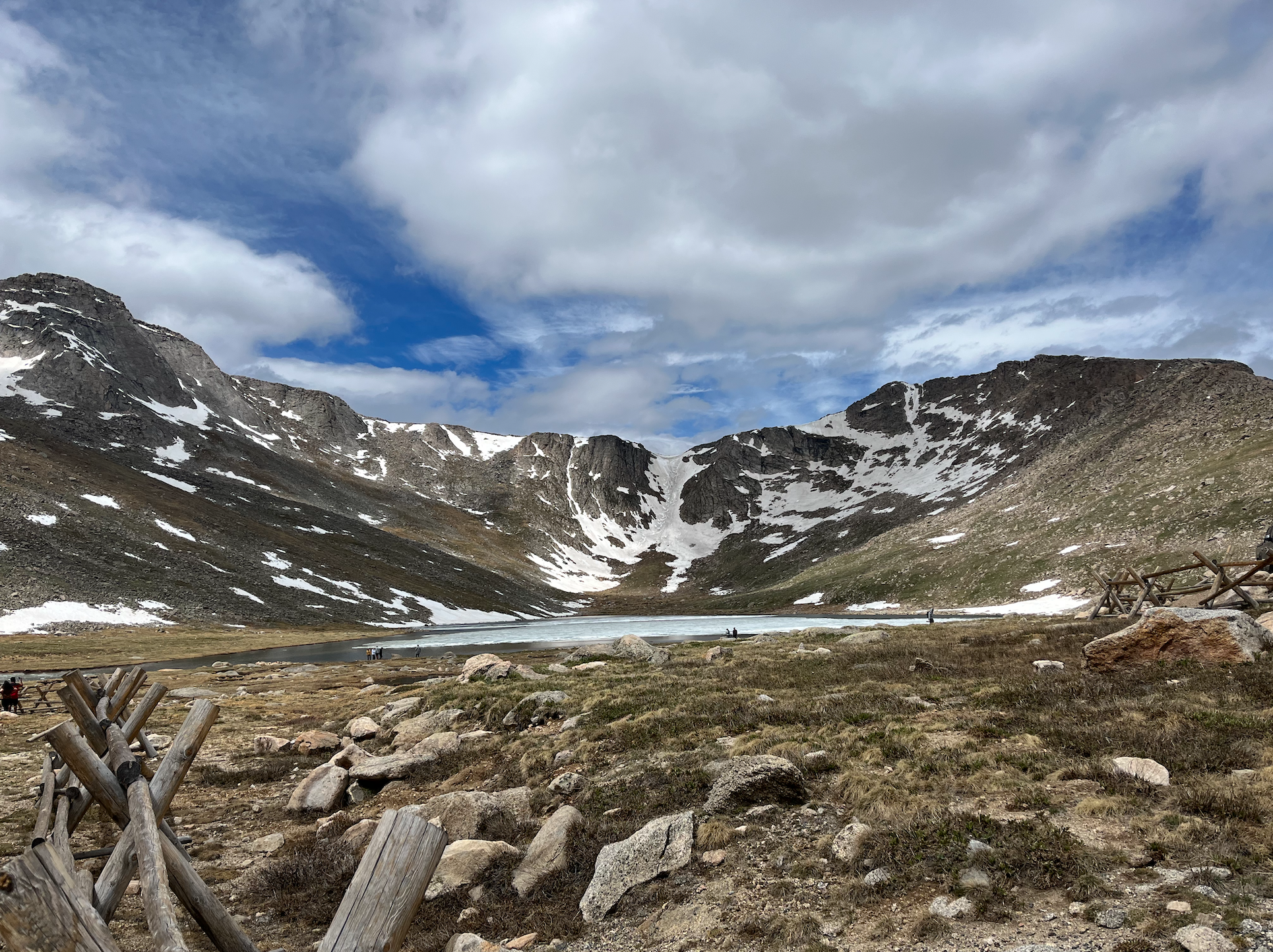
Summit Lake
From the parking area, you’ll begin on a marked trail that leads you around the lake and up to the summit of Mount Spalding, which has an elevation of 13,840′. The initial ascent out of the parking lot is almost entirely uphill, and you’ll gain around 1,000′ of elevation in about a mile. This portion of the trail is well-marked with cairns, and I had no issues sticking to the route. After around 45 minutes I made it to the summit of Mount Spalding where I stopped for a quick snack. From here, you’ll have fantastic views of Mount Evans and the surrounding mountains.

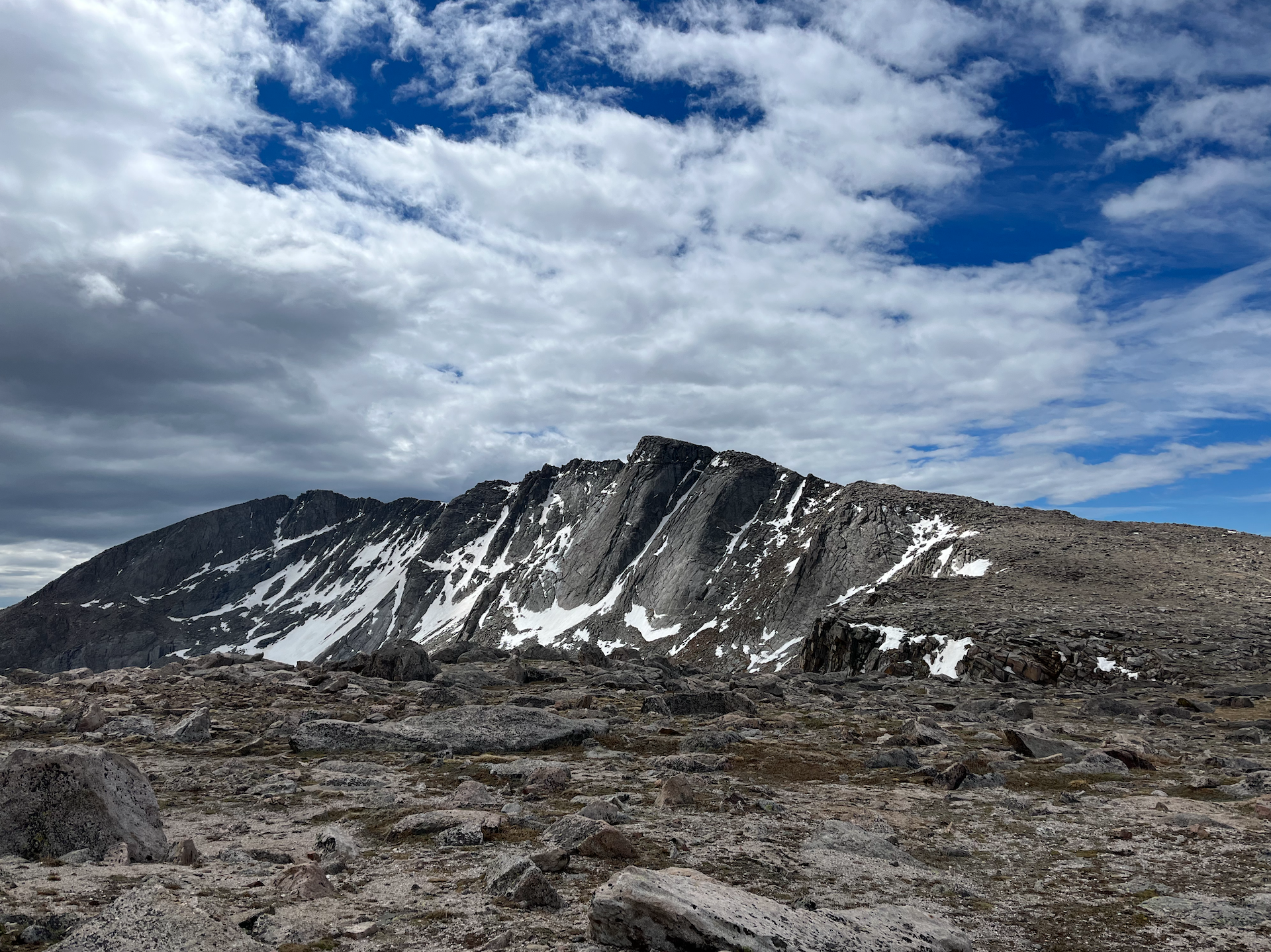
Views from Mount Spalding
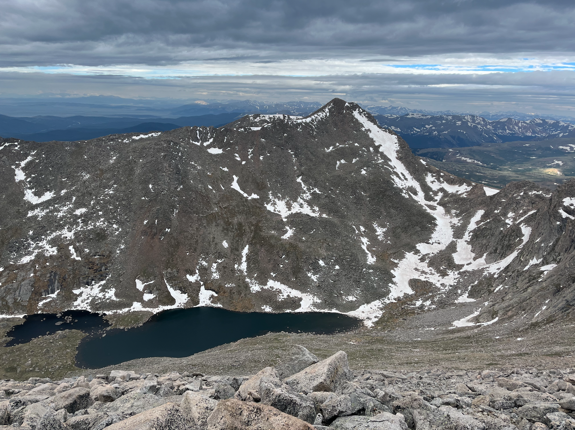
The next portion of the trail leads you down and over a saddle that will connect you with the ridge that eventually leads to the summit of Mount Evans. As of June 18 there was still a little bit of snow on the trail, but nothing too serious. The saddle is a welcome break from the ascent to Mount Spalding, and the trail is very easy to follow.
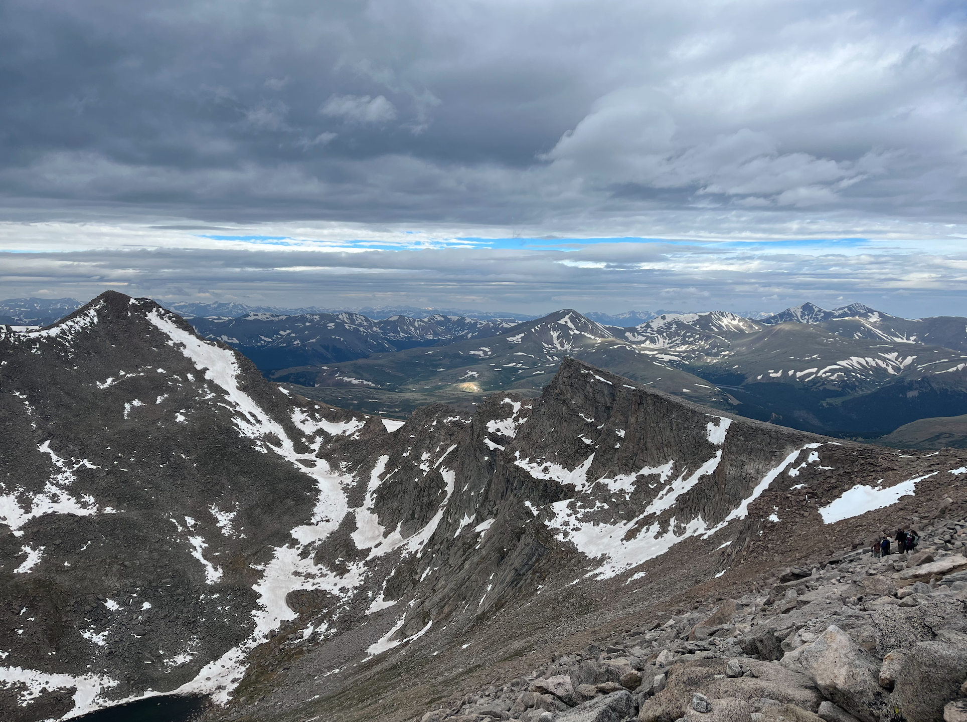
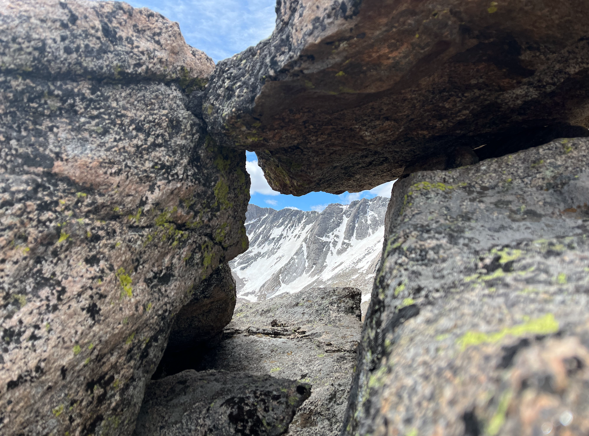
Views from the rocky ridgeline
Once you reach the rocky ridgeline, your pace will likely slow down significantly as you have to step carefully in certain areas and keep a sharp eye out for cairns. I didn’t have any issues sticking to the trail, but I really took my time and didn’t rush through this section. My main priority was to prevent altitude sickness and keep a steady pace. There is a bit of a false summit that you’ll hike around, and the trail stays below the ridgeline for the last mile or so. Eventually, the road and summit complex will come into view and you’ll finish the ascent on some moderate switchbacks that lead you to the summit.

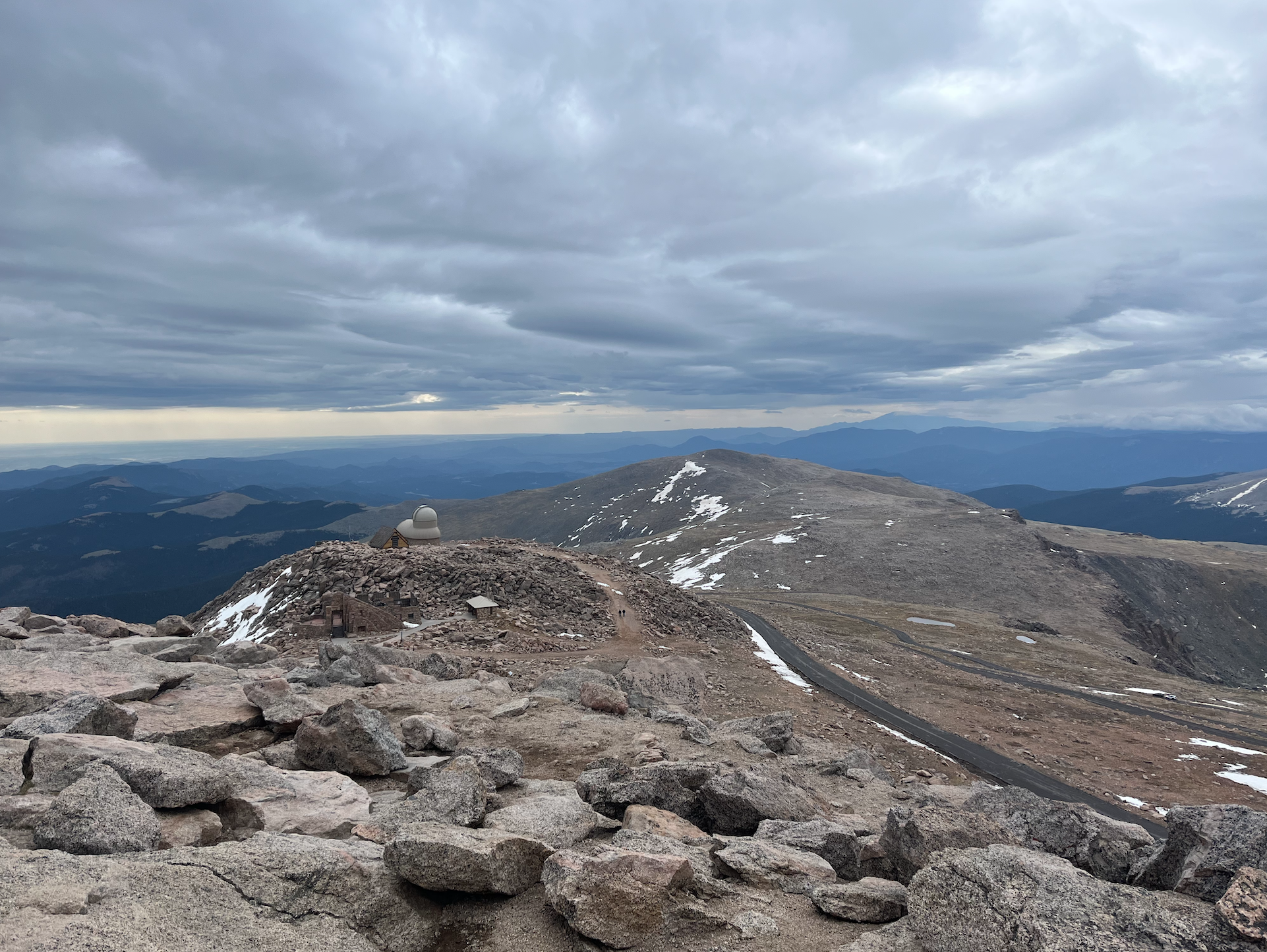

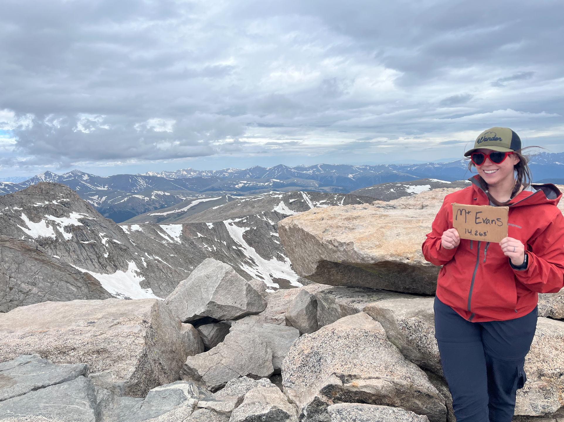
Views of the trail, summit complex, survey marker, and an obligatory summit photo!
After snacking on a sandwich and grabbing some photos at the summit, I began the descent. I would say heading back down the trail almost felt rougher than going up. Going downhill on such rocky terrain was uncomfortable on my knees, and I did stray off-trail once or twice. I believe there are a few routes along the rocky ridgeline and I managed to get off of the main one, which is the easiest. I’ll also note that my watch ended up tracking the hike as closer to 6.75 miles in total. All in all, I was back at my car by 11:30, so I wrapped up the hike in almost exactly 5 hours. I felt totally fine during the hike but was hit with some altitude sickness once I made it back to the car. I definitely recommend staying well-hydrated and bringing plenty of snacks to combat this as much as possible. If you’re visiting from out of town, it’s also important to let yourself acclimate to the elevation before attempting this hike.

If you squint you can spot a marmot!
I thoroughly enjoyed the hike from Summit Lake to Mount Evans. It was sufficiently challenging that I felt I was pushing myself, but not so hard that I questioned my ability to summit. For locals, I’m sure this hike is a walk in the park! I would definitely recommend this hike if you’re visiting from out of town or looking for a beginner-friendly 14er.

What temperatures did you experience at those altitudes?
LikeLike
I believe temps were around 40-50 degrees Fahrenheit. It was very windy so I wore hiking pants, a base layer long sleeve shirt with a rain/wind jacket on top.
LikeLike