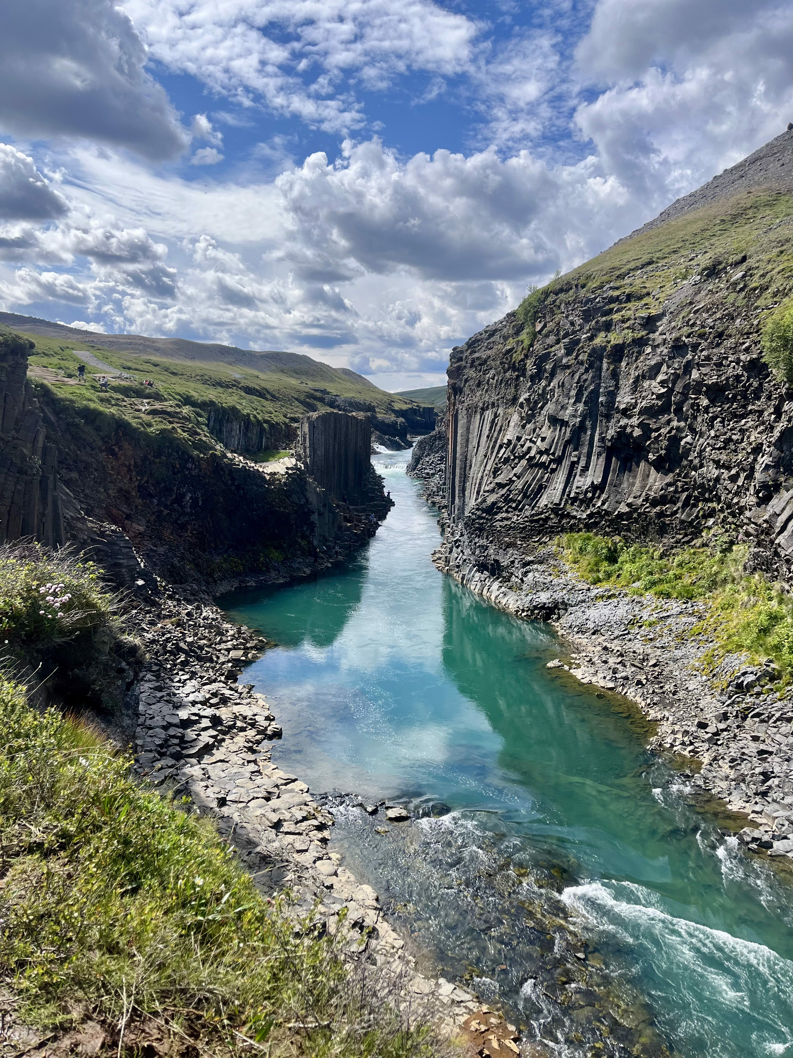
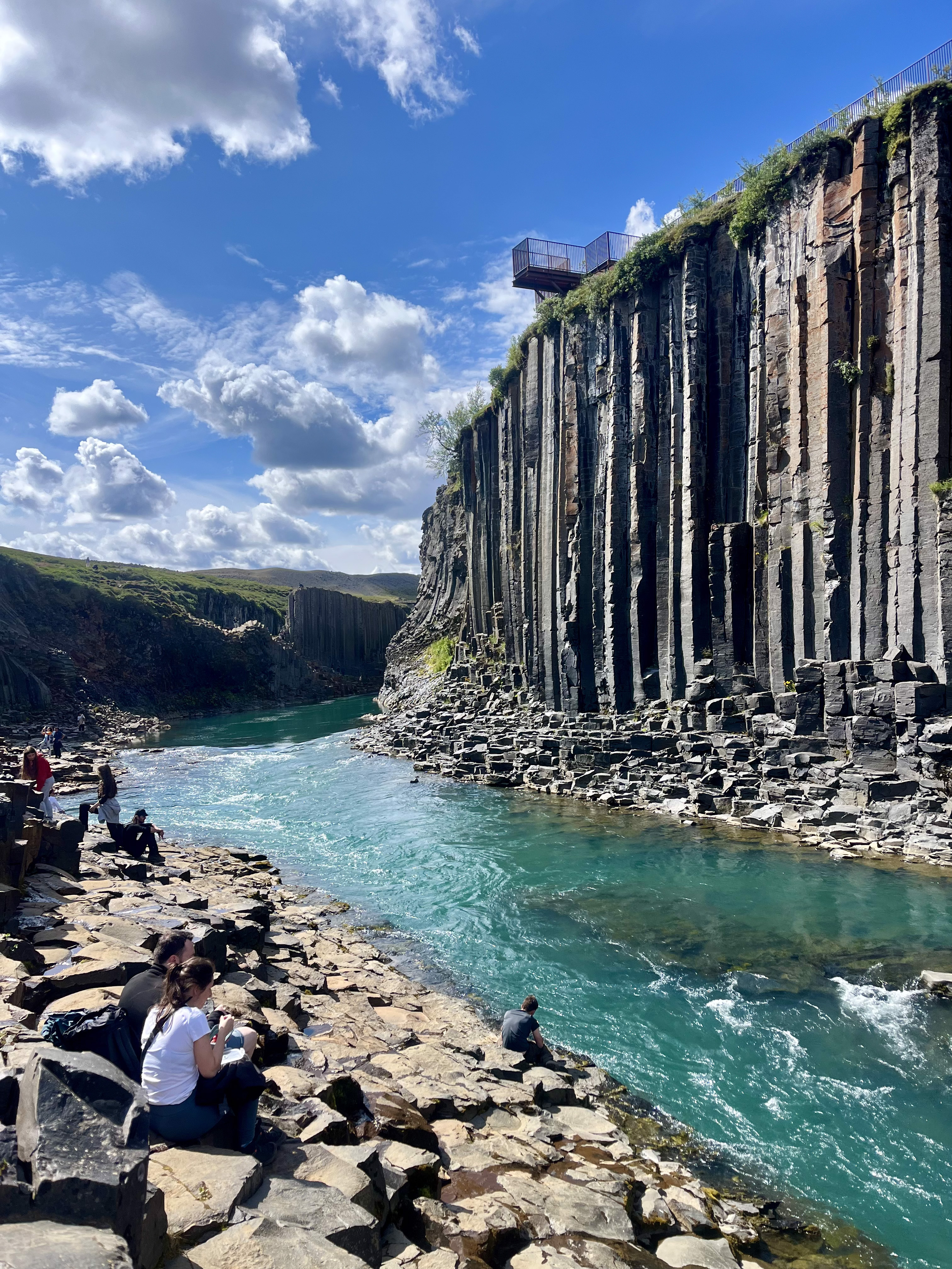
If you’re planning a trip to Iceland and want to tackle an easygoing hike with one-of-a-kind views, Stuðlagil Canyon is the perfect option. This picturesque outdoor area is renowned for its stunning rock formations and crystal-clear blue waters. The canyon consists of basalt rock columns that form unique hexagonal shapes around a river called the Jökulsá á Dal (or Jökulsá á Brú). As a result, Stuðlagil Canyon has an almost otherworldly appearance, making it a popular stop for travelers to Iceland.
This Iceland hiking guide for Stuðlagil Canyon has everything you need to know about hiking to this iconic Icelandic landmark!
Stuðlagil Canyon Hike

Stuðlagil Canyon Facilities + Parking
Stuðlagil Canyon is located in eastern Iceland’s Jökuldalur Valley, which translates to Glacier Valley. From Egilsstaðir, the largest town in East Iceland, the drive to the canyon is about an hour. While you can explore both sides of Stuðlagil Canyon, the eastern side offers better views and the chance to hike down to the water. From the western side, you can only see the canyon via some small observation platforms.
Pro tip: Stuðlagil Canyon is located off Road 923. Since the road is gravel, driving to the canyon can get bumpy, but it’s manageable in a 2WD vehicle when conditions are dry. 4WD is recommended if you’ll be driving in rain or snow.
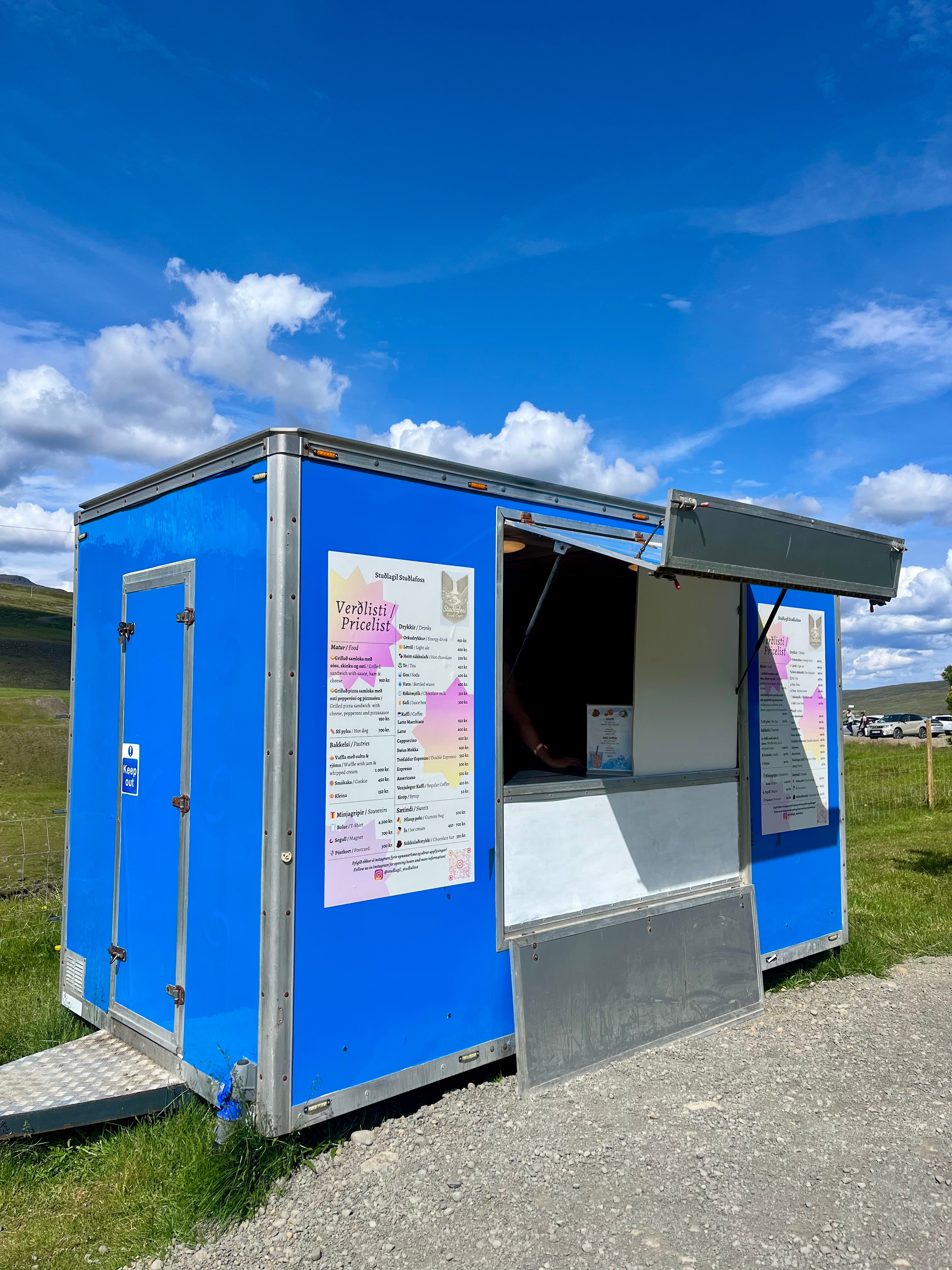
If you have limited time, the west side is preferable because parking is free (there’s a small fee to use the restrooms) and the walk to the canyon viewpoint is relatively short. The east side of the canyon features two parking lots—the first/furthest one is free, while the second/closer one is 1000 ISK (~$8) and has restrooms. During the summer months, a food truck sets up at the paid lot on the east side offering beverages, baked treats, and quick café-style bites.
Pro tip: I suggest parking in the second/paid lot on the east side to save time, because it cuts around 3 miles off the total hiking distance.
Hiking to Stuðlagil Canyon

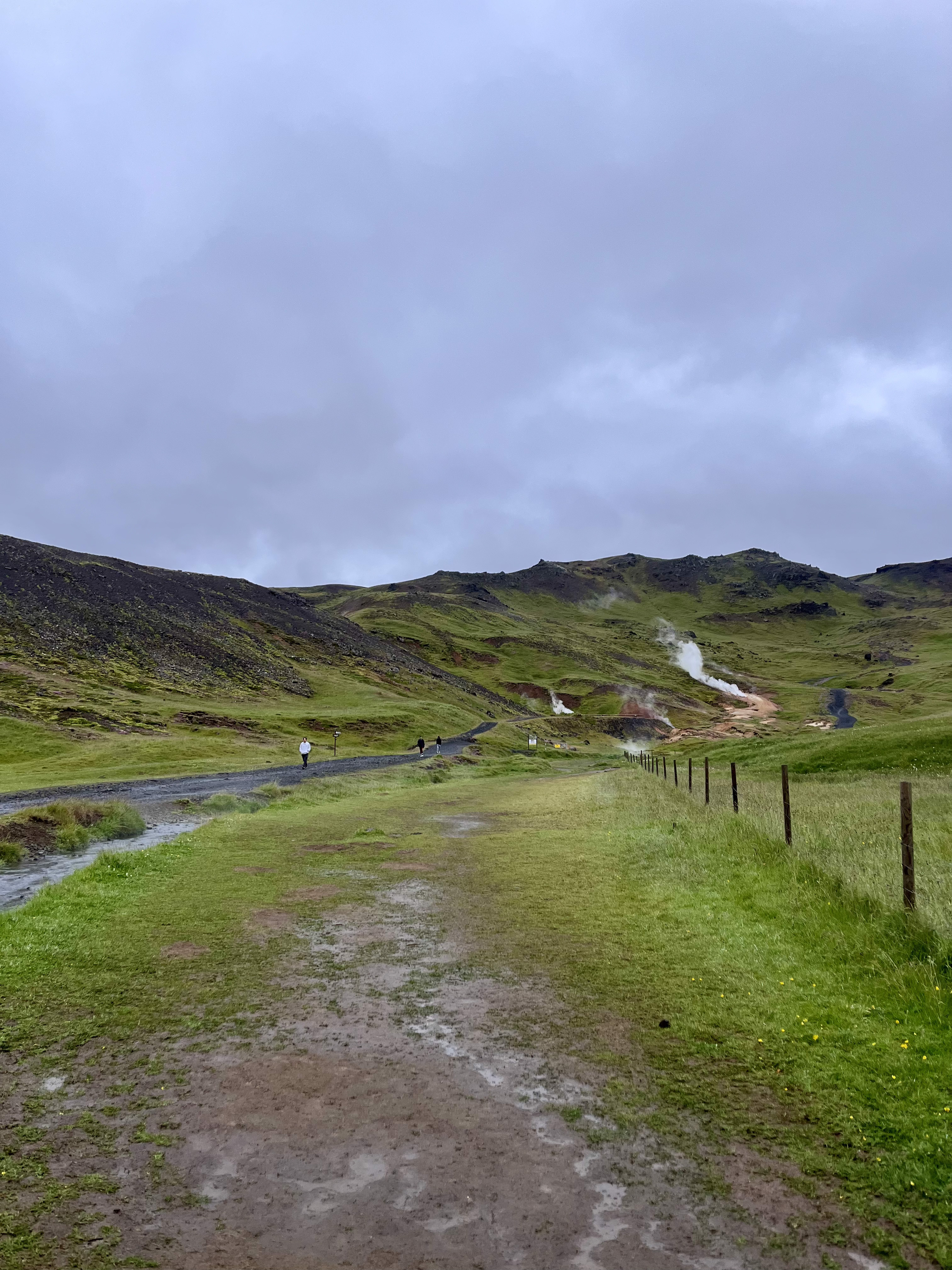
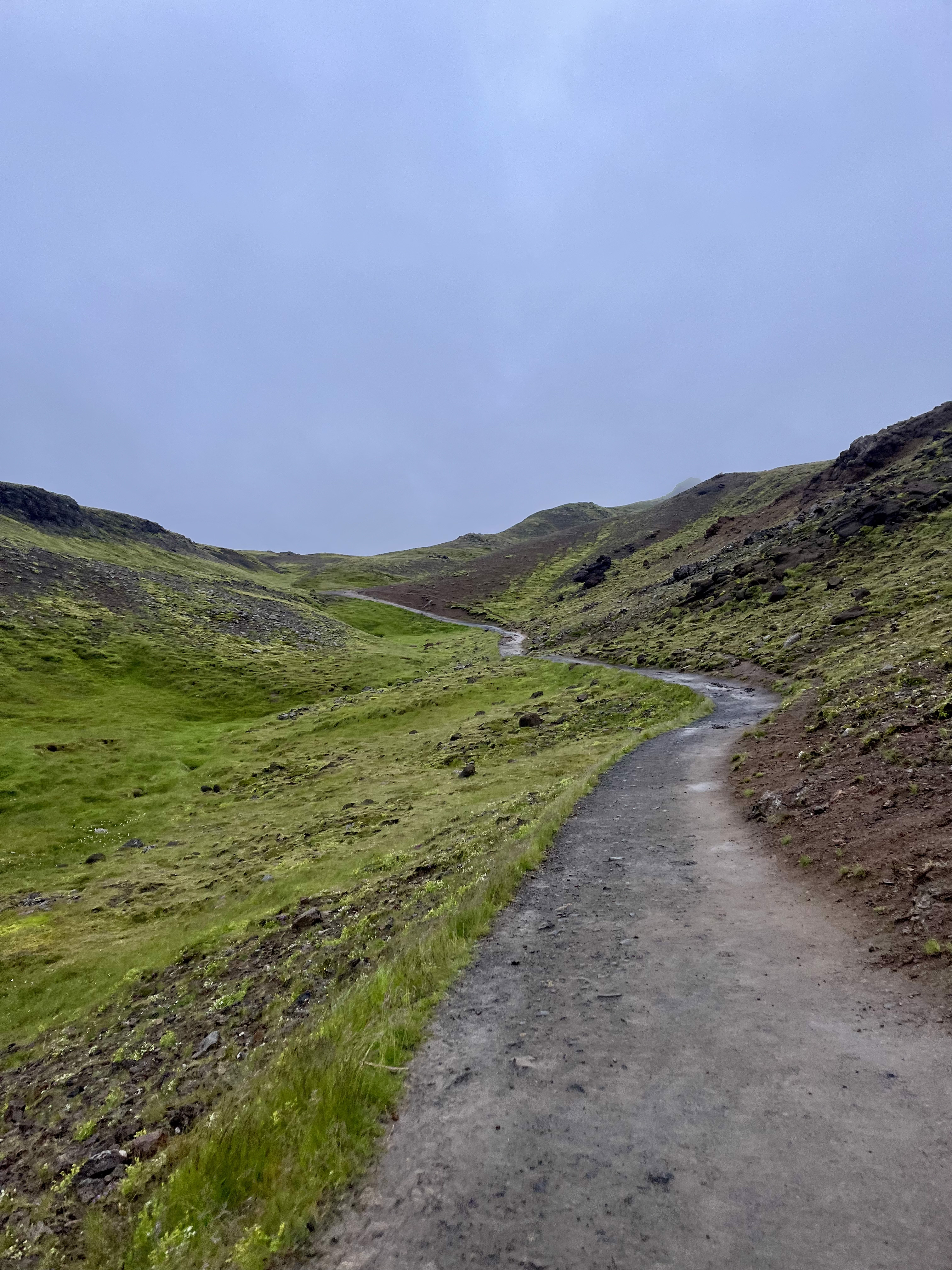
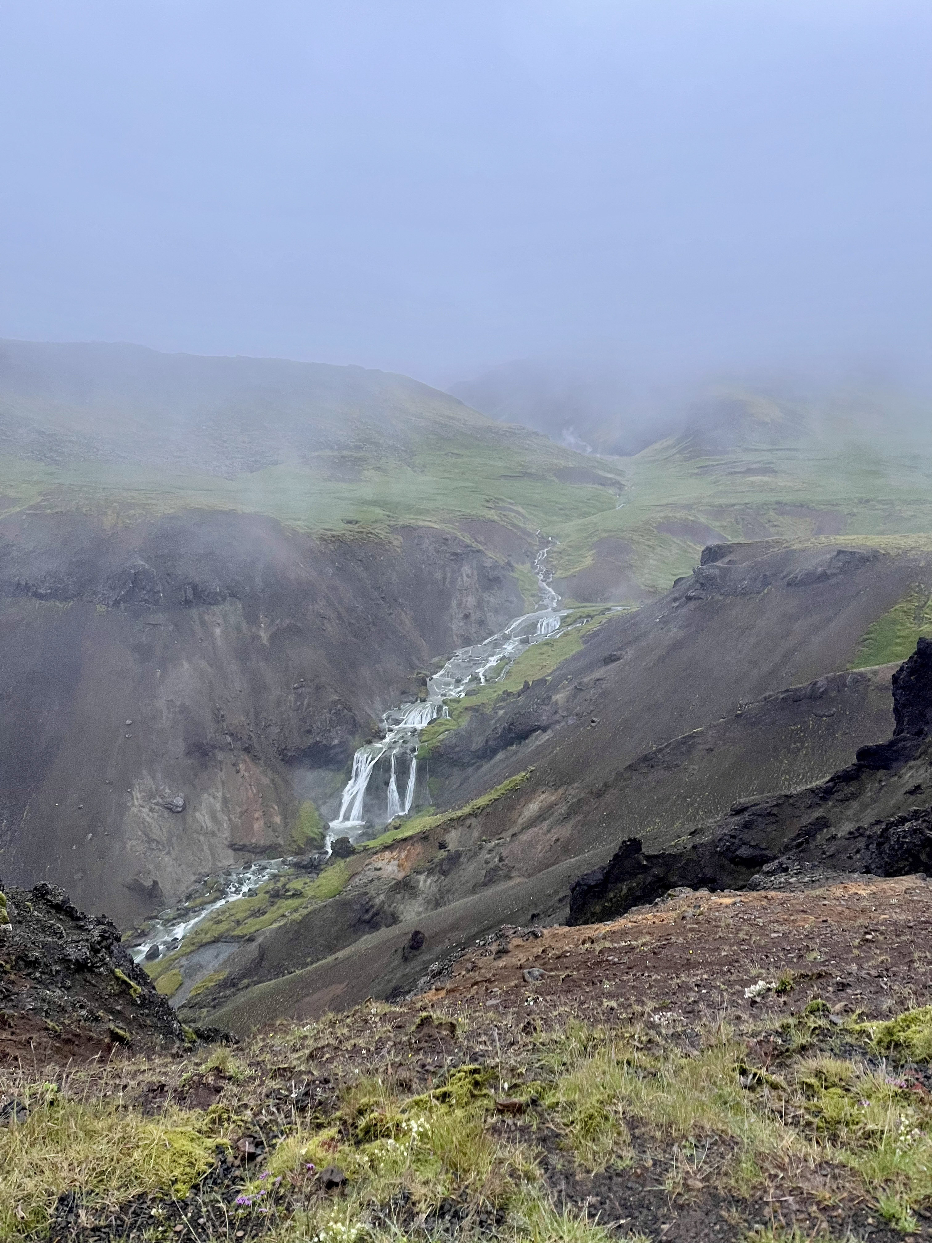
From the paid lot on the east side of Stuðlagil Canyon, the hike is about three miles total. The trail follows a relatively flat gravel path through quaint farm land. Along the way, you’ll pass Stuðlafoss, a beautiful waterfall boasting those famous rock columns. Don’t forget to keep an eye out for sheep!


After about a mile and a half of leisurely walking, you’ll reach the edge of the canyon. The views from above are spectacular, but I highly recommend hiking down into the canyon as well. Doing so will let you get up close and personal with the striking rock formations and vibrant blue water. My husband, Solomon, and I had a lot of fun wandering around the rocky river banks and admiring the serene landscape.
Pro tip: Early summer is the best time to see the river’s signature turquoise color. In late summer and fall, the water becomes murky and brown.
Stuðlagil Canyon Final Thoughts
Definitely check out Stuðlagil Canyon if you already plan to be in the East Iceland region. The hike located on the east side is short and beginner-friendly, but it will reward you with jaw-dropping views. Take the time to trek down into the canyon, and bring some snacks to enjoy along the river’s edge. If you’re pressed for time or don’t care to hike, the canyon’s western side is a great alternative for a quick stop.
Check out my other Iceland travel guides:
8.5-Day Iceland Itinerary | Ring Road, Diamond Circle, Snæfellsnes Peninsula
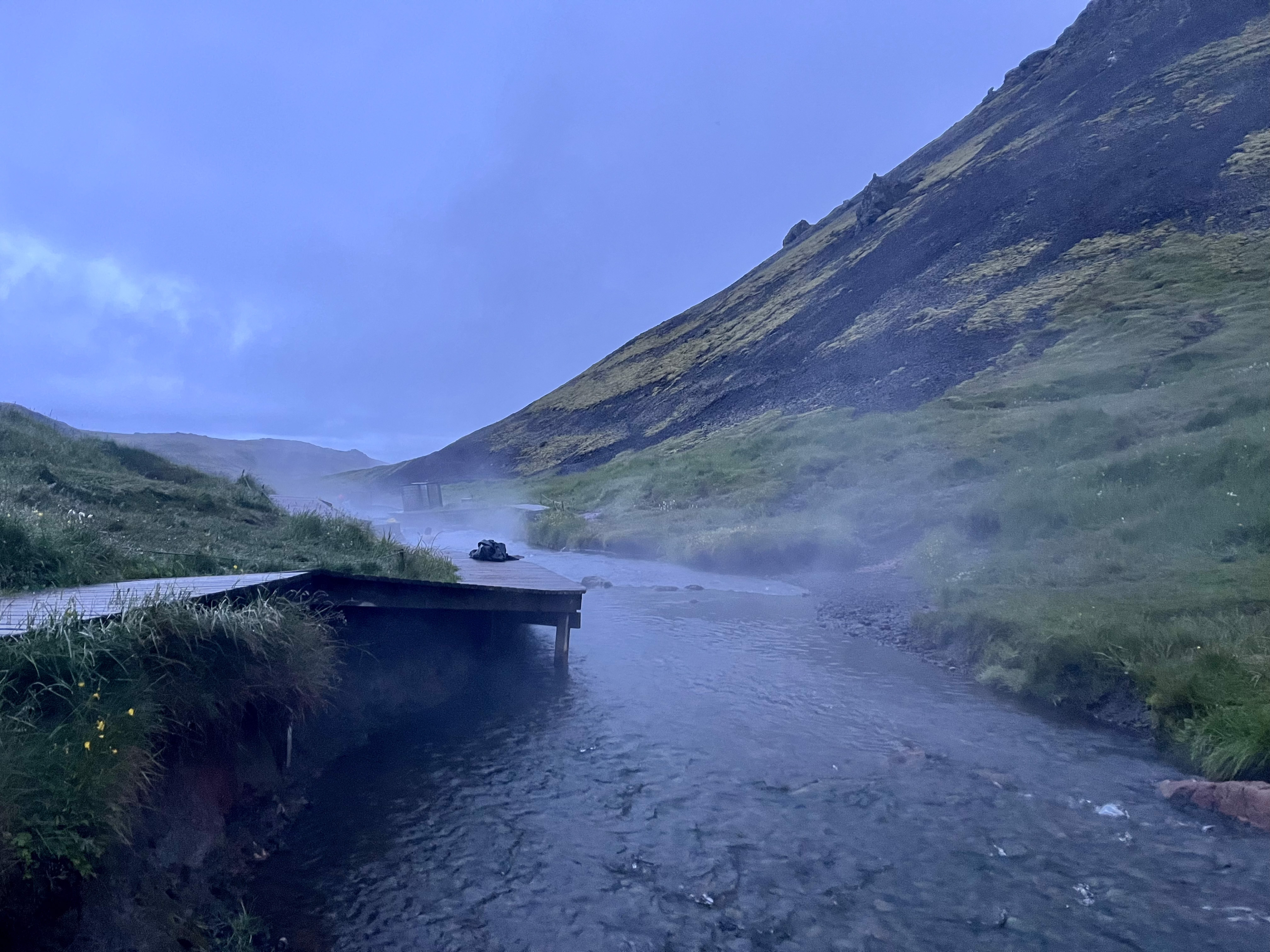
Reykjadalur Hot Springs | Iceland Hiking Guide
Must-Try Icelandic Foods | Iceland Food Guide
Sky Lagoon or Blue Lagoon? Iceland Travel Guide
Top 10 Things to Do in Reykjavík | Iceland Travel Guide
Top 7 Snæfellsnes Peninsula Things to Do | Iceland Travel Guide
Should You Book a Reykjavík Food Tour? Iceland Food Tour Review